Chad Stonehocker
R. Adam Dastrup, MA, GISP
GEOG-1780
19 March 2017
“Captain America the Winter soldier”
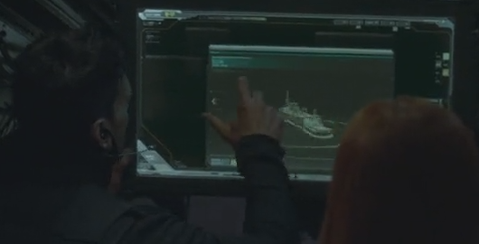
As the company that made the movie states, “Marvel’s “Captain America: Civil War” finds Steve Rogers leading the newly-formed team of Avengers in their continued efforts to safeguard humanity, but after another incident involving the Avengers results in collateral damage, political pressure mounts to install a system of accountability, headed by a governing body to oversee and direct the team.” (Marvel) As soon as we are introduced to the film and our main character we are off to the first mission and we have imagery that looks like a CAD design where we are spinning and rotating the image. The characters allude to satellite imagery, but it is identifiable as computer rendered plans and schematics, perhaps this is one reason why our expectations of actual imagery and perceived capability are off somewhat from modern technology.
This however isn’t an insider or movie review we’re trying to ascertain how Hollywood has used geospatial technology with satellite imagery to bring our reality into movie magic and or madness in this film.
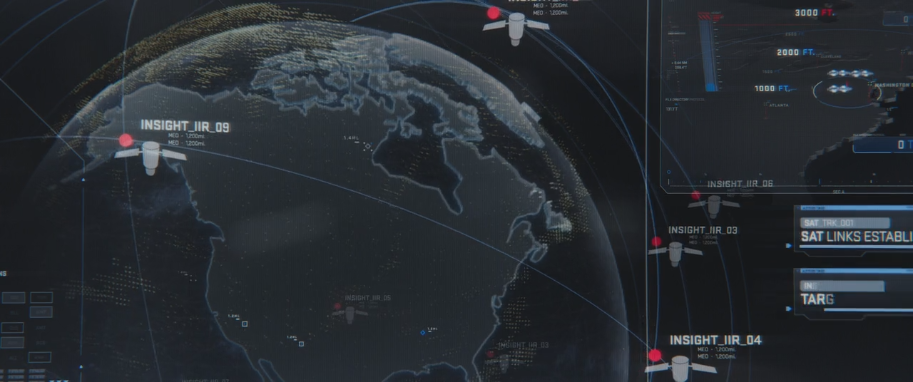
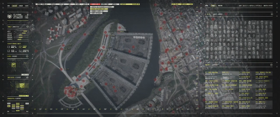
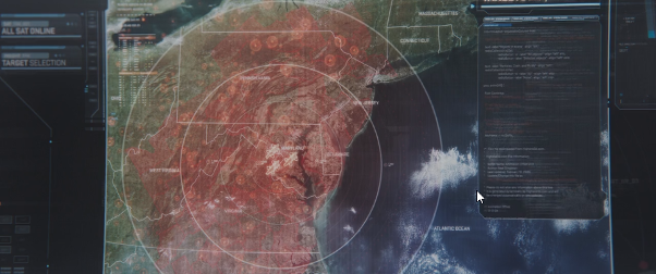
Let’s take this one step at a time. Many of the views that the film uses in military planning and logistics is inferred to be from satellites, especially during the concluding scenes of the movie. As we utilize tools for satellite images we note that most images due to the distance of the camera to the position on the ground are very vertical in nature, so we can determine that the show only used satellite imagery during the end sequences while targeting the eastern seaboard locations with their “Algorithm” to find all of the people to be removed.
In moving the story forward, we see at the suspenseful timed sequence where we are one minute to firing the locations are being identified and painted with targets the film states satellite targeting, but you can see that they are using a combination of satellite location and aerial camera focusing in combination; so they aren’t being very particular about keeping their technologies separate or identified.
The film did well depicting the reality of aerial photography, unfortunately the utilization was very small in nature and large in promise. As noted at skytango, they were able to identify “7 Hollywood Movies Filmed with Drones” (Hennessy) where in years past we may have seen images from a Helicopter, but now with advanced cameras, miniaturization, and stabilization technology these drones are affecting our view of the world
Movies that utilized Drones and the resulting video's.
The Wolf of Wall Street (2013)
Captain America: Civil War (2016)
In conclusion, as a plot point and moving a story forward geospatial technology is secondary to the utilization of aerial photography and its versatility to film more safely and dramatically in Hollywood.
Works Cited
Captain America: The Winter Soldier. Dir. Joe Russo Anthony Russo. Perf. Samuel L. Jackson, Scarlett Johansson Chris Evans. 2014. Film.
Hennessy, Una. Drones In Movies: 7 Hollywood Movies Filmed With Drones. 18 Feb 2016. Mar 2017. <https://skytango.com/drones-in-movies-7-hollywood-movies-filmed-with-drones/>.
Marvel. Captain America Civil War. 2017. march 2017.

|
Classifying Imagery Using ArcGIS.pdf Size : 103.282 Kb Type : pdf |